| Magnitude | 4.8 |
| Region | DOMINICAN REPUBLIC |
| Date time | 2026-09-27 21:49:47.3 UTC |
| Location | 18.539 ; -69.068 |
| Depth | 110 km |
| Distance | 27 km ENE of San Pedro de Macorís, Dominican Republic / pop: 217,000 / local time: 17:49:47.3 2026-09-27 16 km NW of La Romana, Dominican Republic / pop: 208,000 / local time: 17:49:47.3 2026-09-27 |
Source parameters reviewed by a seismologist
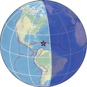
Tsunami information at:
US (NOAA)All data providers for this event:
URGeo, Geoazur (Universite Cote d'Azur, IRD, CNRS, Observatoire de la Cote d'Azur) -- Port-au-Prince, Haiti (AYIT)EMSC - CSLOC -- Arpajon, France (CSLC)
GeoForschungsZentrum (GFZ) -- Potsdam, Germany (GFZ)
Geophysical Survey of the Russian Academy of Sciences -- Obninsk, Russia (GSRAS)
Instituto Portugues do Mar e da Atmosfera -- Lisbon, Portugal (IPMA)
Ukrainian NDC, Main Center of Special Monitoring -- Kyiv, Ukraine (MCSM)
National Earthquake Information Center, U.S. Geological Survey -- Golden, United States (NEIC)
EMSC -- Arpajon, France (SC4)
Universidad Autonoma de Santo Domingo -- Santo Domingo, Dominican Republic (UASD)
Further information can be found at:
Universidad Autonoma de Santo Domingo -- Santo Domingo, Dominican Republic (UASD)National Earthquake Information Center, U.S. Geological Survey -- Golden, United States (NEIC)
GeoForschungsZentrum (GFZ) -- Potsdam, Germany (GFZ)